Edward Roberts' diagrams and plans
From: The Court House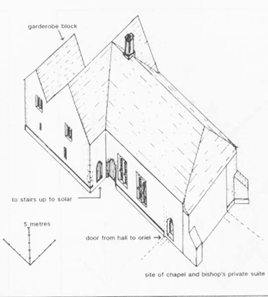
The Hall at The Court House drawn by Edward Roberts

Willliam of Wykeham's House from the north-west. (The seventeenth=century farm house wing and twentieth century building have been omitted

Ground floor plan, showing positions of the bishop's chapel and the oriel leading from the hall to his private suite. At the north end is the garedrobe block with latrine chute (L). The first floor plan shows the great chamber (or solar) and the garderobe block.

Edward Roberts elevation of the west side of The Hall.
Edward Roberts

Edward Roberts elevation of south side of The Hall.

The environs. 1, All Saints Church. 2 18th century barn. 3. Demolished farm buildgins. 4. The Court House. 5. The pond. 6. 17th century farmhouse wing.


No Comments
Add a comment about this page